Forging a bright and sustainable future together.


Wallace, ID
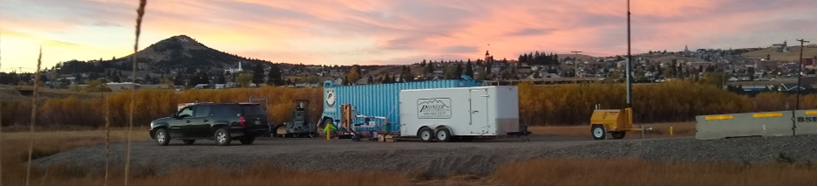
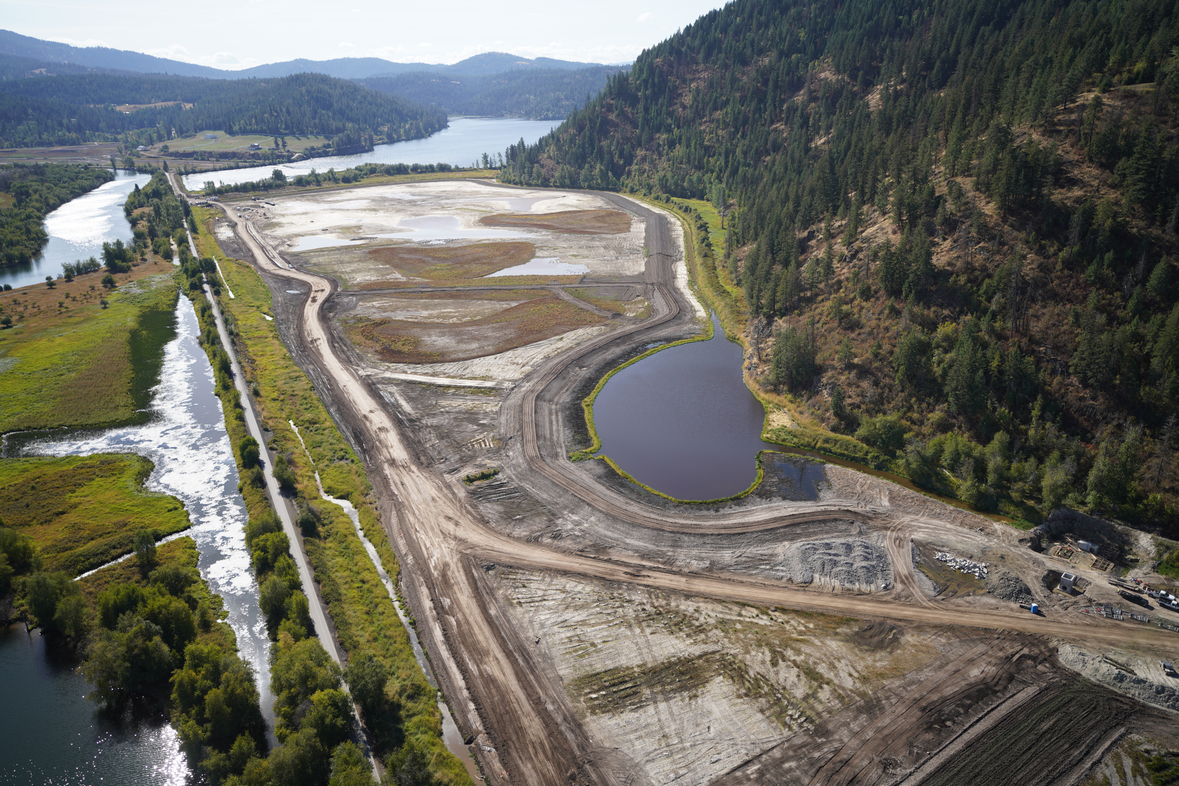
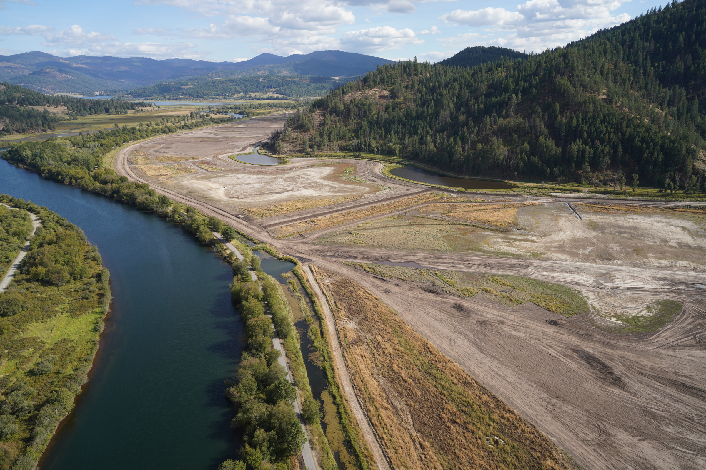
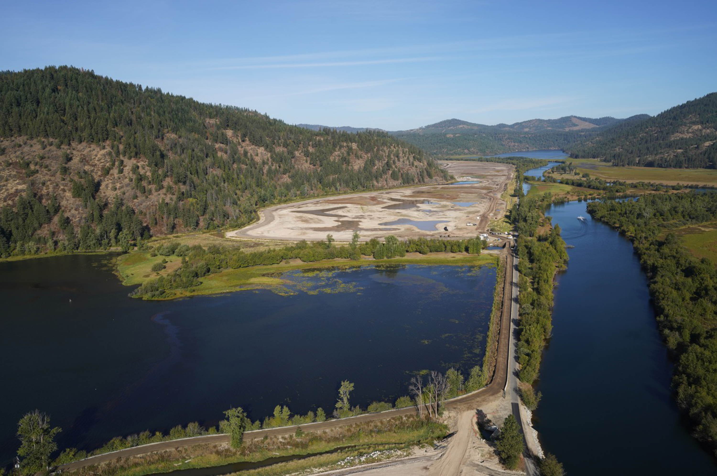
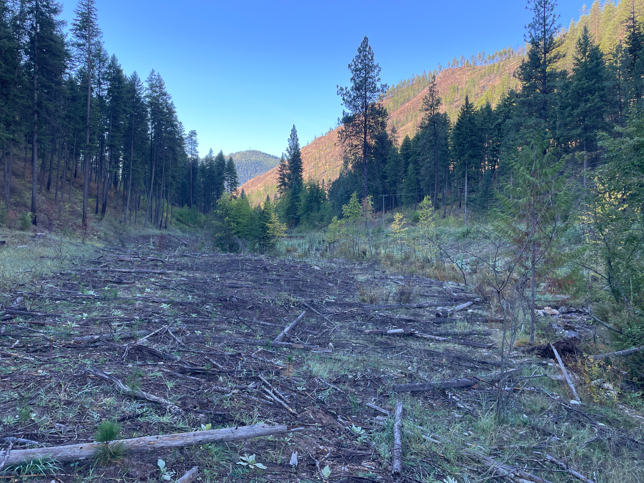
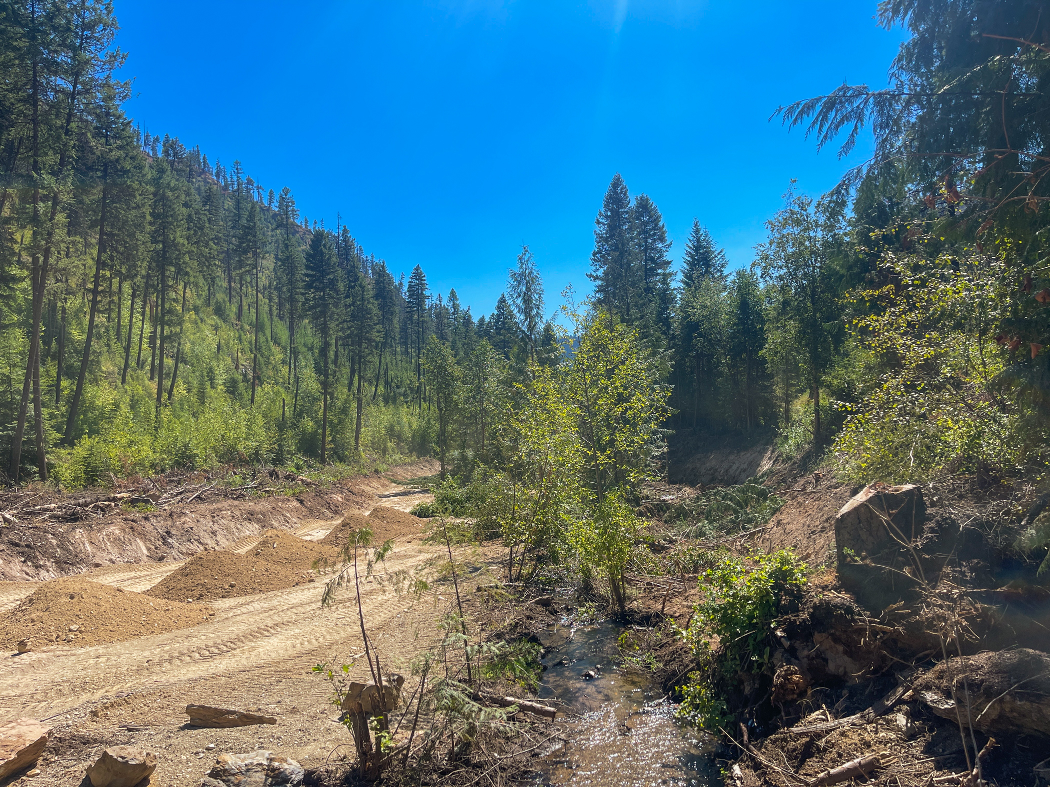
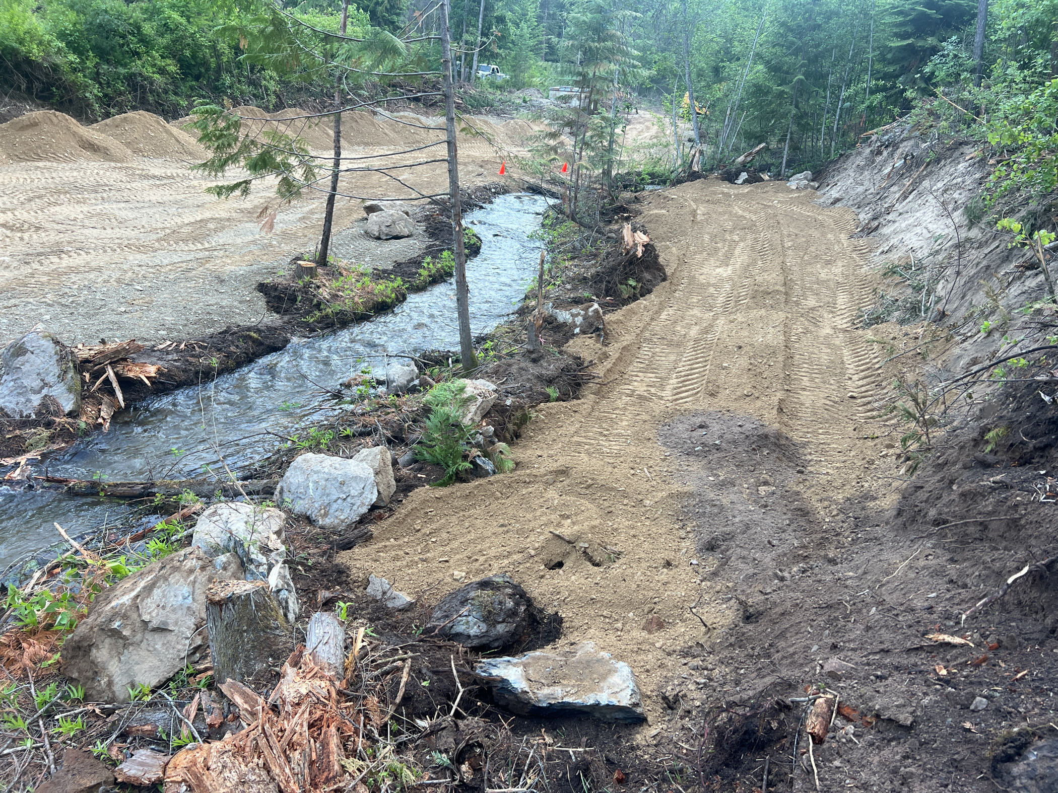
The Lower East Fork Ninemile Creek and Dayrock Complex, located in the Ninemile Creek Basin, encompasses riparian areas affected by historical mining activity upstream, as well as the Dayrock Mine and Millsite. The site required remediation to address these impacts and restore the affected areas to a more natural and stable condition.
The project involved the excavation and removal of over 381,000 BCY (bank cubic yards) of mine waste contaminated with lead and zinc, which posed environmental and health risks. After excavation, these areas were backfilled with clean materials to restore the landscape. Key tasks included regrading and capping selected portions of the site to isolate residual contamination, reconstructing approximately 1.7 miles of stream channels for East Fork Ninemile Creek, West Fork Ninemile Creek, and Ninemile Creek, and constructing stormwater drainage channels to manage runoff. Various Best Management Practices (BMPs), such as planting native vegetation and installing conifer and riparian tubelings were implemented to prevent erosion and support long-term recovery.
By the end of the fourth and final year of construction in November 2024, the project successfully remediated 29 acres of affected area. This total area included sections covered with clean cover soil to promote vegetation and sections capped with road base material to create stable driving surfaces.
Forsyth, MT
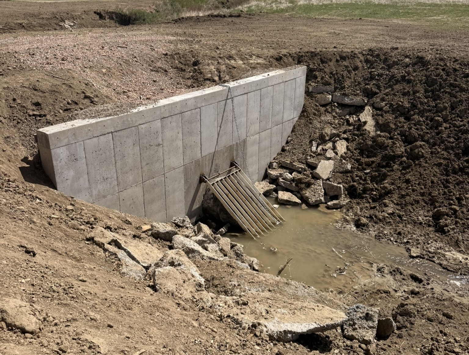
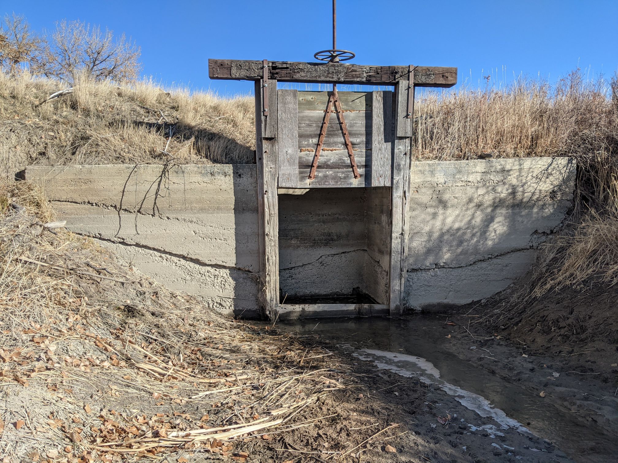
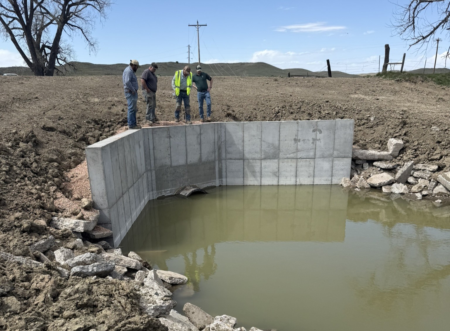
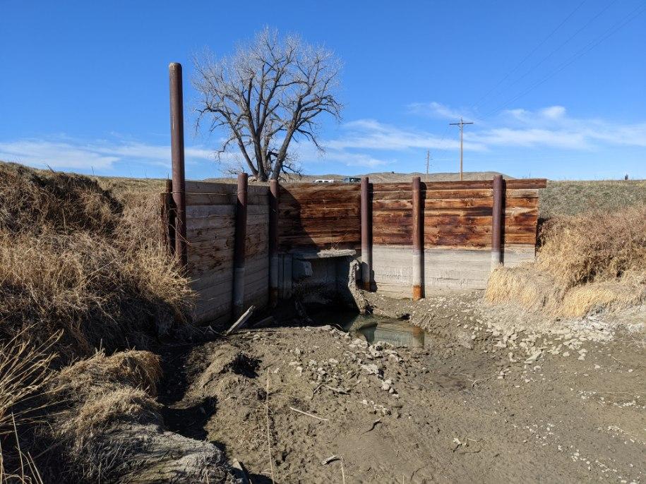
The overall goal of the Big Porcupine Creek Siphon Replacement Project was to eliminate water loss at the siphon, reduce or eliminate impacts to Big Porcupine Creek at the siphon location, and provide a long-term reliable siphon solution for the Hammond Irrigation District (HID).
Funds from ARPA & DNRC grants were used to replace and relocate the deteriorated siphon inlet structure, replace the deteriorated siphon outlet structure, and replace the leaking siphon pipe under Big Porcupine Creek with 48-inch HDPE pipe. Completion of this project ensures that irrigation water sourced from the Yellowstone River is effectively and efficiently delivered, via the HID canal, to 3,782 irrigated acres of agricultural land within the Yellowstone River valley near Forsyth, Montana.
Kootenai County, ID

Gray’s Meadow is located in the Lower Basin of the Coeur d’Alene River in Kootenai County, Idaho, and is currently owned and managed by the Idaho Department of Fish and Game. Gray’s Meadow is a 695-acre agricultural field consisting of two areas (the Cave Lake Wetland and the Lamb Peak Wetland) being converted to functional wetlands. Soil and sediment within Gray’s Meadow are impacted with mining-related metals, which have been deposited through flooding, from extensive upstream mining and ore processing in the Upper Basin of the Coeur d’Alene River.
The site is being remediated and restored to wetlands to provide a clean habitat for waterfowl and other animals. The design includes constructing embankment and water control features to manage water levels within each cell of the wetlands. Habitat features, including loafing islands and ponds, are being constructed within each cell to provide the necessary habitat for waterfowl and migratory birds.
Helena, MT

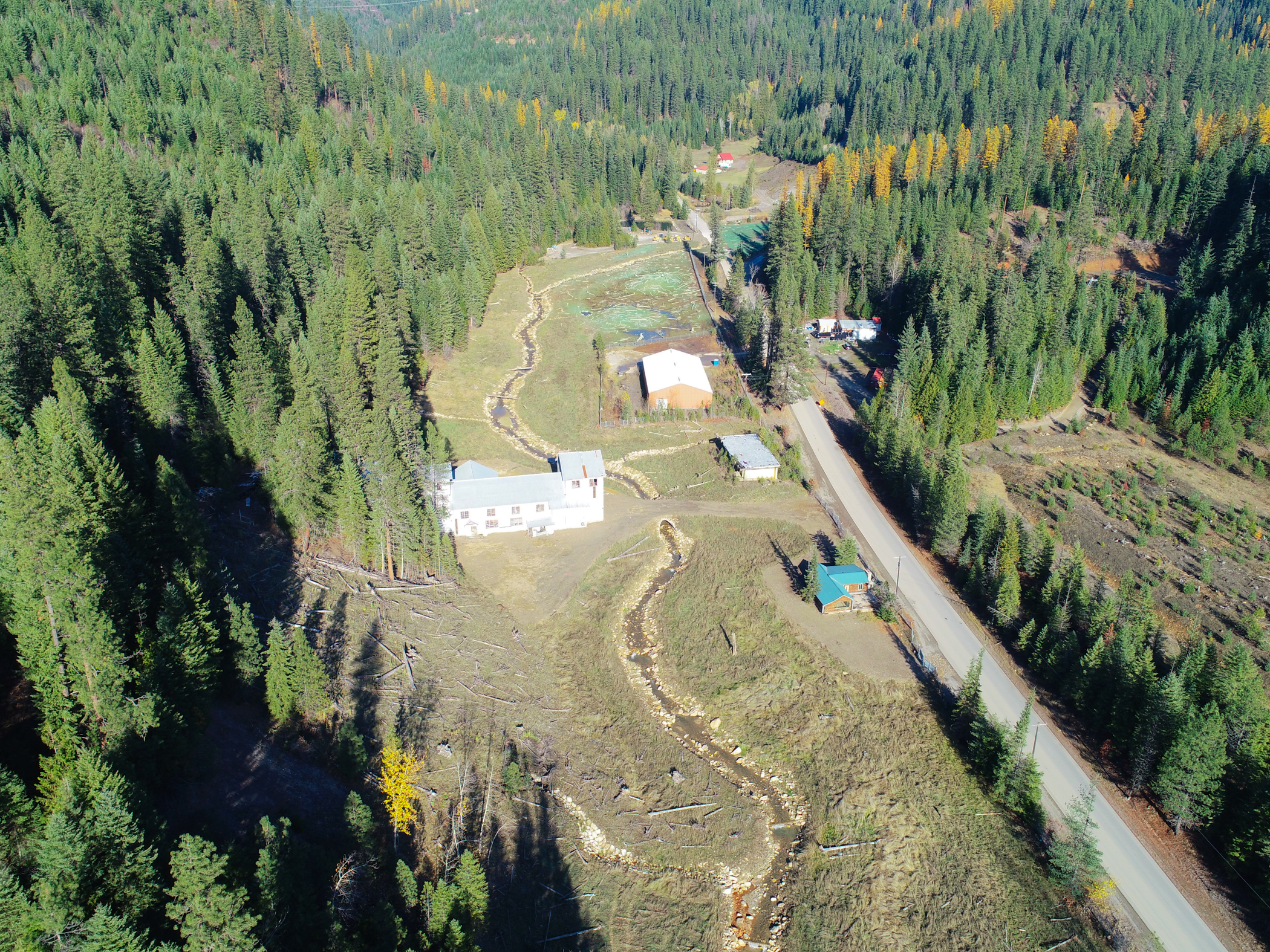
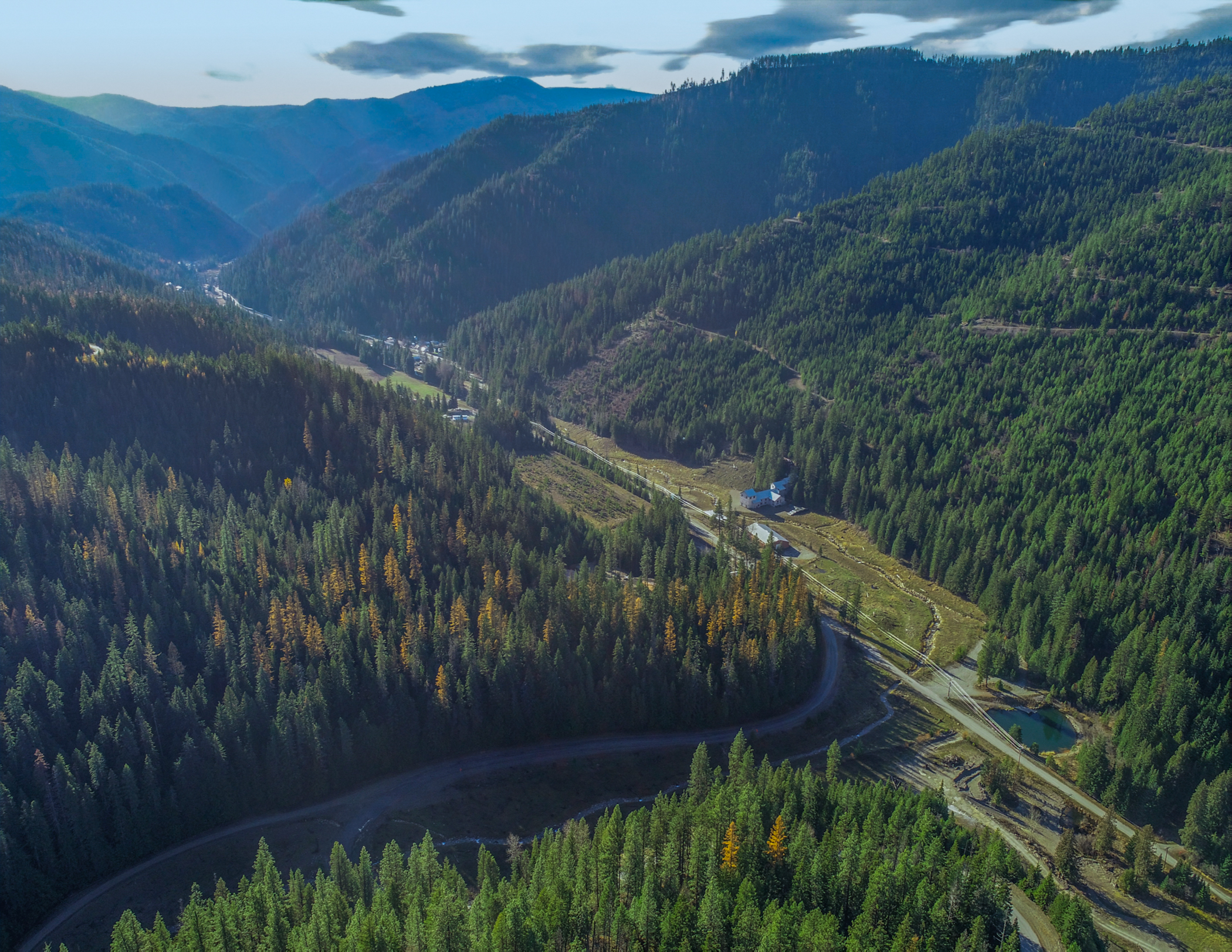
The IMM Site was added to the National Priorities List (NPL) of Superfund sites on September 23, 2009. Site contamination resulted from historic hard rock mining and milling operations in the area. The Flat Creek IMM operated from 1909-1930 and from 1947-1953 processing silver, gold, lead, copper, and zinc ores. The Site is located northeast of the town of Superior, Montana, in the Flat Creek drainage that discharges to the Clark Fork River at Superior.
Pioneer designed the first waste removal, Wood Gulch waste repository and reclamation of the upper reaches of Flat Creek for MT DEQ in 2016, work that was completed in 2018. The USDA Forest Service, partnered with Trout Unlimited, is now implementing a plan for removal and disposal of waste materials from the downstream reaches of Flat Creek into a Pioneer-designed expansion of the Wood Gulch repository. Our involvement is to provide the oversight of the repository construction, removal of floodplain and streamside mine tailings deposits, placement of mine waste in the repository, remediation of floodplain, and repository closure.
Butte, MT

The BRW Smelter Area Mine Waste Remediation and Contaminated Groundwater Hydraulic Control is in Butte, Montana. Historically, the Site included several different smelting and other industrial operations. These operations left behind a complex distribution of materials (including slag, tailings, demolition debris, foundations, and other historical structures), impacted soil, and groundwater.
Since 2017, Pioneer has collected information needed to refine the characterization of groundwater and solid materials within the Butte Reduction Works (BRW) Site. We completed detailed sampling plans outlining the scope of the field activities, sampling procedures and protocols, quality assurance/quality control procedures, and Site-specific health and safety hazards followed by multiple Site investigations, which included:
We compiled all the data into a Microsoft Access database specific to the project. Laboratory data underwent Stage 4 or Stage 2A data validation. From the evaluation, we prepared comprehensive Data Summary Reports comparing the data to the Data Quality Objectives in the original sampling plans and qualifying the data based on these Data Quality Objectives criteria.
Pioneer is currently using the data obtained from these Site investigations to guide remedy design and implementation activities.
Geotechnical and Geophysical Site Investigations
As a result of the various past operations at the Site, various structures and materials within the Site must be considered when developing the remedy design. We completed multiple geotechnical and geophysical Site investigations to gather additional geotechnical information on the structures and materials within the Site, which included:
Soil and Groundwater Modeling
We organized, analyzed and compiled lithology and chemistry data at the Site into a three-dimensional statistical model of Site materials using Leapfrog Works software to interpolate and visualize the different material layers and delineate the extent, magnitude, and volume of waste within the Site. The Leapfrog Works model enhances the understanding of subsurface conditions and is a powerful tool to evaluate waste removal boundaries.
Site remediation includes designing a subsurface hydraulic control system to control discharge of metals-impacted groundwater to surface water and sediment. We organized groundwater data into a conceptual Site model, which we then used to develop a MODFLOW numerical flow model. The model is calibrated to Site conditions and allows multi-year simulations of design and construction scenarios.
Helena, MT
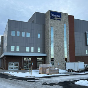
Pioneer recently concluded a comprehensive geotechnical drilling investigation and performed the foundation design for a new 4-story structural steel building, poised at the former mall location in Helena. The project faced a challenge as the team unearthed uncontrolled fill material, a remnant from the demolished mall structure. Further complicating the site conditions, laboratory analysis of consolidation tests indicated that the subgrade soil was prone to significant collapse when saturated. To address these challenges, Pioneer's design incorporated the use of rammed aggregate piers. This innovative technique was instrumental in stabilizing both the uncontrolled fill and the native subgrade soil, significantly mitigating the risk of settlement. In addition to the design phase, Pioneer meticulously oversaw the on-site quality assurance during the installation of the rammed aggregate piers, ensuring the intent of the design was met.
East Helena, MT
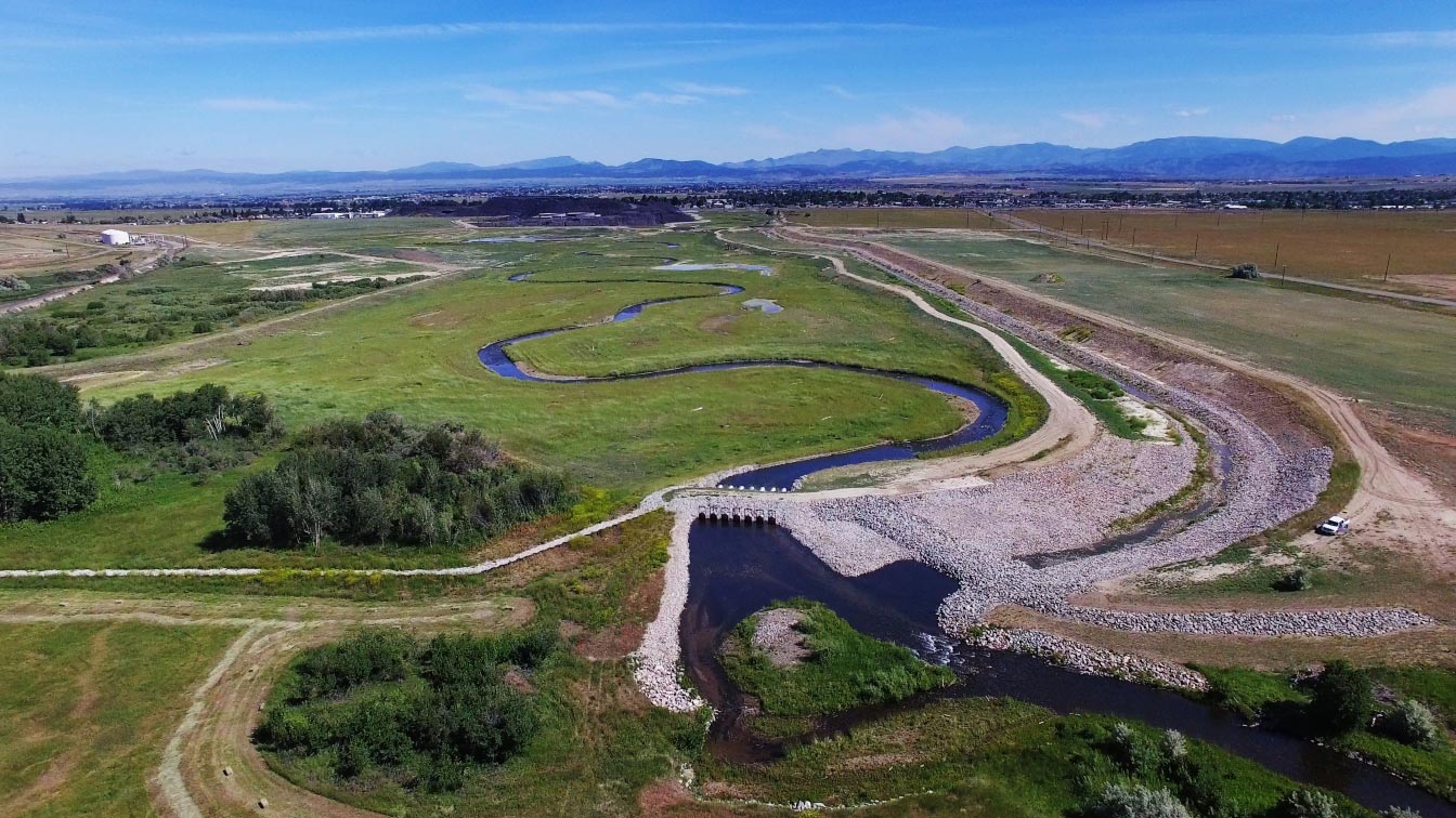
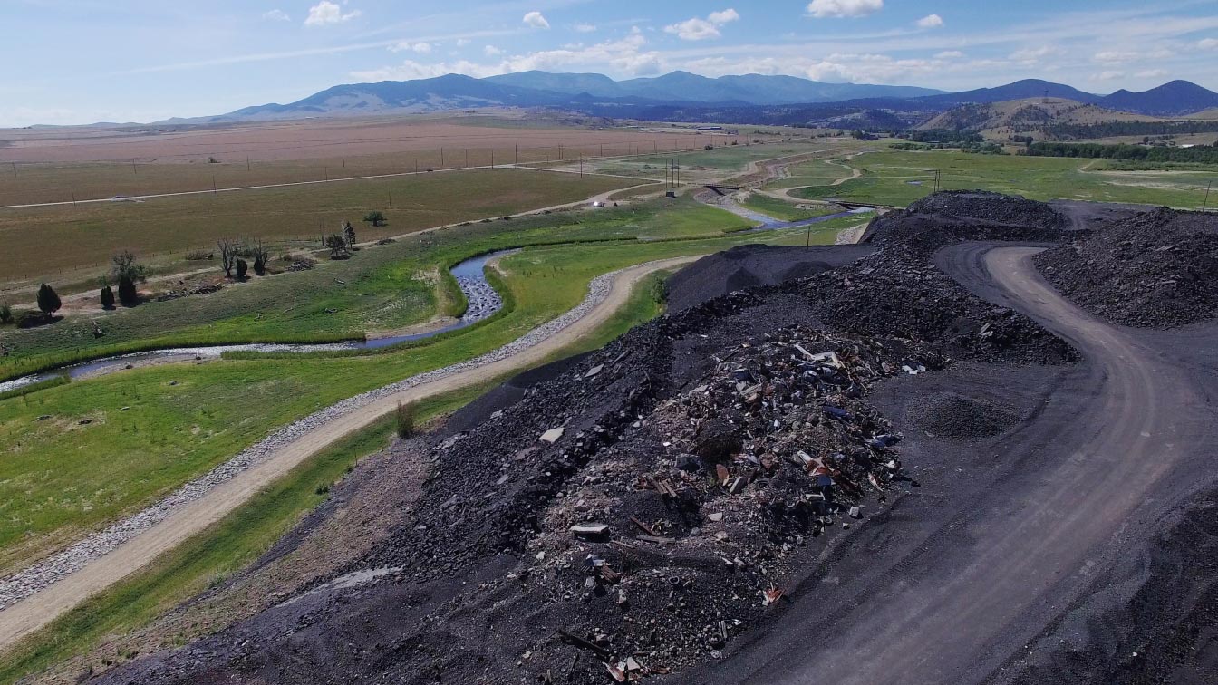
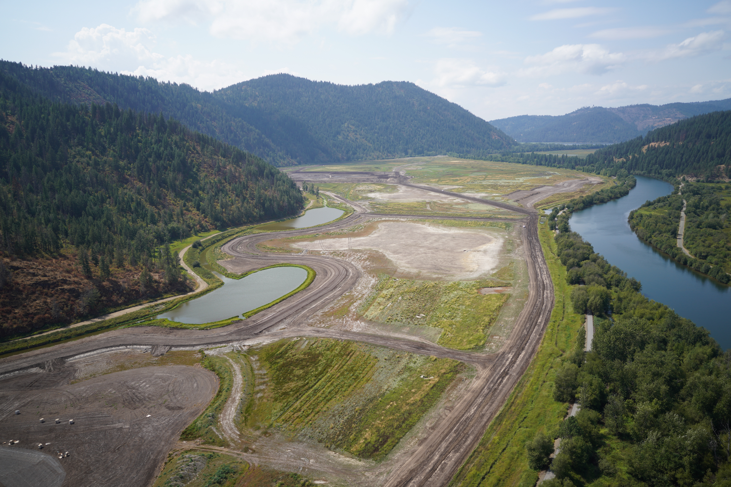
Near Helena, Montana, Pickly Pear Creek was contaminated after a century's worth of smelter activities deposited arsenic, lead, and other containments into its soil and groundwater. A 5-year cleanup solution included lowering the groundwater and restoring the creek to its natural channel. This included moving over a million cubic yards of materials.
FIDIC - 2019 International Merit Award
ACEC - 2019 Grand National and Montana Engineering Excellence Awards.
Montana Contractors Association - Special Recognition Excellence Awards for Water Quality and Habitat Restoration.
Since 2011, Pioneer has provided a full range of planning, data collection, environmental permitting, remedial design, project management, construction management, and monitoring services at the East Helena Smelter Resource Conservation and Recovery Act Site to support corrective measures implemented to remediate contaminated soil and groundwater at the site. The project removed a derelict dam and impacted reservoir sediments and then relocated approximately 1.25 miles of Prickly Pear Creek and its floodplain to the eastern margin of the site. These actions permanently lowered groundwater beneath the entire site and reduced groundwater flux through inaccessible contaminated soils which reduced contributions to the contaminated groundwater plume without long-term pumping.
Pioneer completed the following major activities:
Powell County, MT
Scope of Work
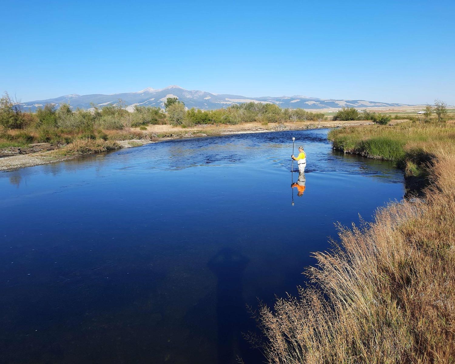
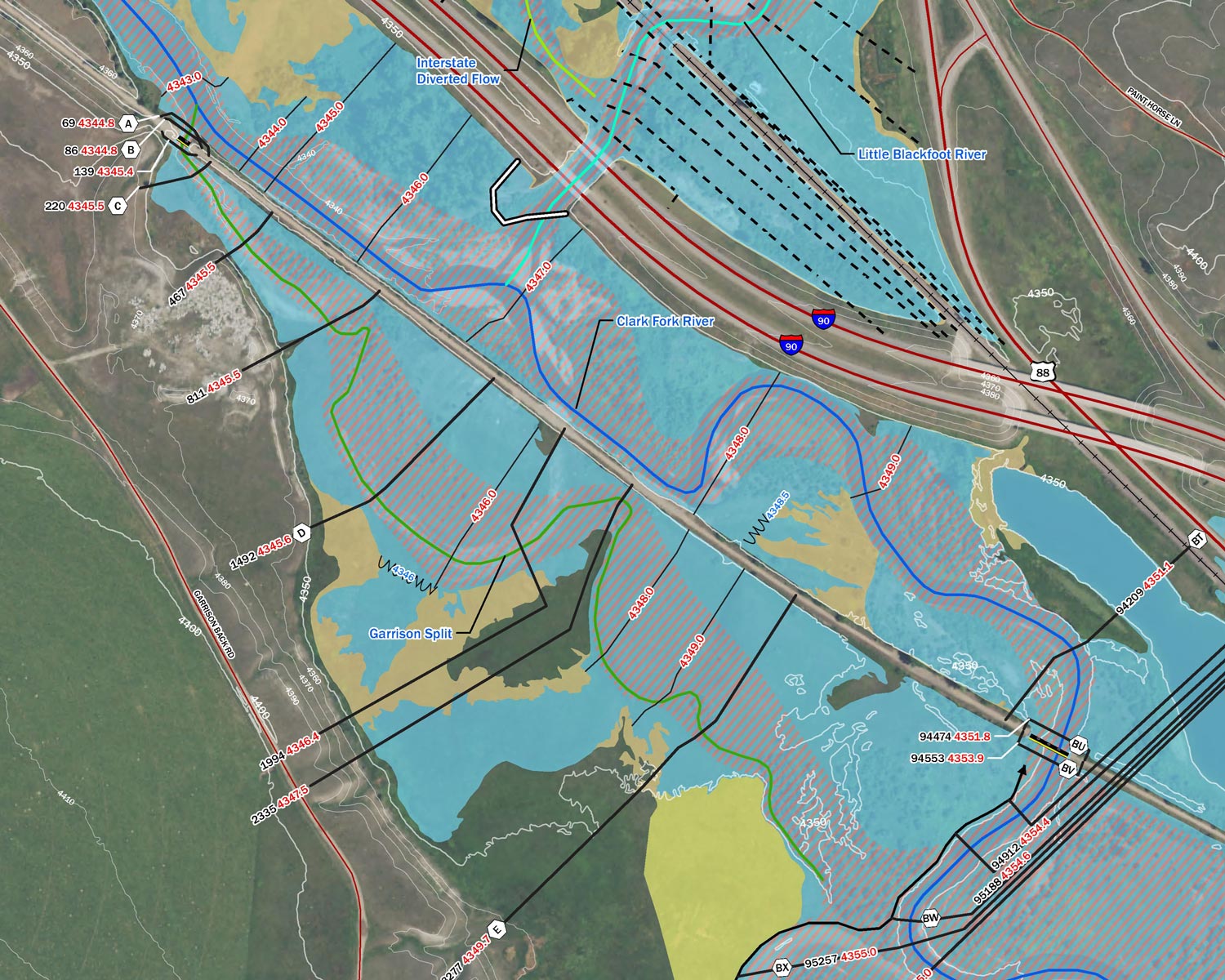
As part of the Powell County Modernization project, Pioneer performed detailed survey, structure inventory, and site visits on the Clark Fork, Blackfoot, and Little Blackfoot Rivers and their tributaries. This work included hydraulic structure survey of 105 hydraulic structures, bathymetric channel crosssection survey at 182 channel locations and survey of reference marks at 8United States Geological Survey (USGS) gaging stations. Structure Inventories of 74 stream spanning structures were performed. A total of 66 site visits were performed. All survey tasks and data acquisition were performed in accordance with FEMA and DNRC guidance standards.
Project Performance
Results of the survey tasks were compiled into a report and submitted to DNRC and FEMA. The project was completed on schedule and within the original budget.
Knowledge Enhancement & Lessons Learned
In the Global Positioning System (GPS) structure survey work early stages, field data was uploaded daily for engineering QA/QC and to expedite the development of structure drawings in AutoCAD. The QA/QC team members realized that field crews were collecting more survey points than needed to define the required bridge and culvert elements for modeling. These additional points were slowing both QA/QC and drafting efforts. In response, Pioneer developed a more concise and standardized list of required survey points and relayed the information to the survey field team. This updated method was used for the remainder of the GPS survey data acquisition and increased the efficiency of the survey field team, the QA/QC process, and the hydraulic engineering team.
Santa Cruz County, AZ
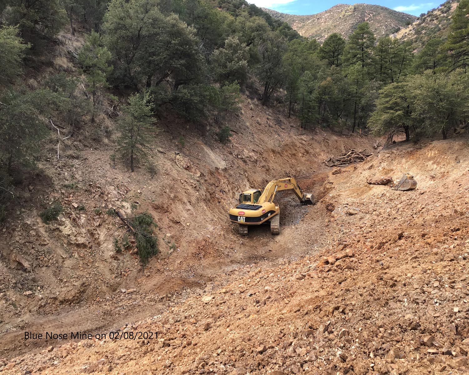
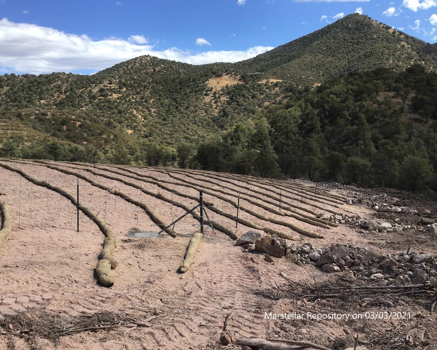
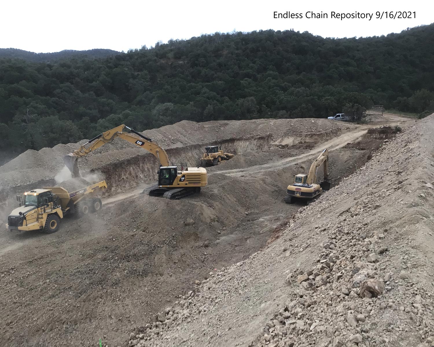
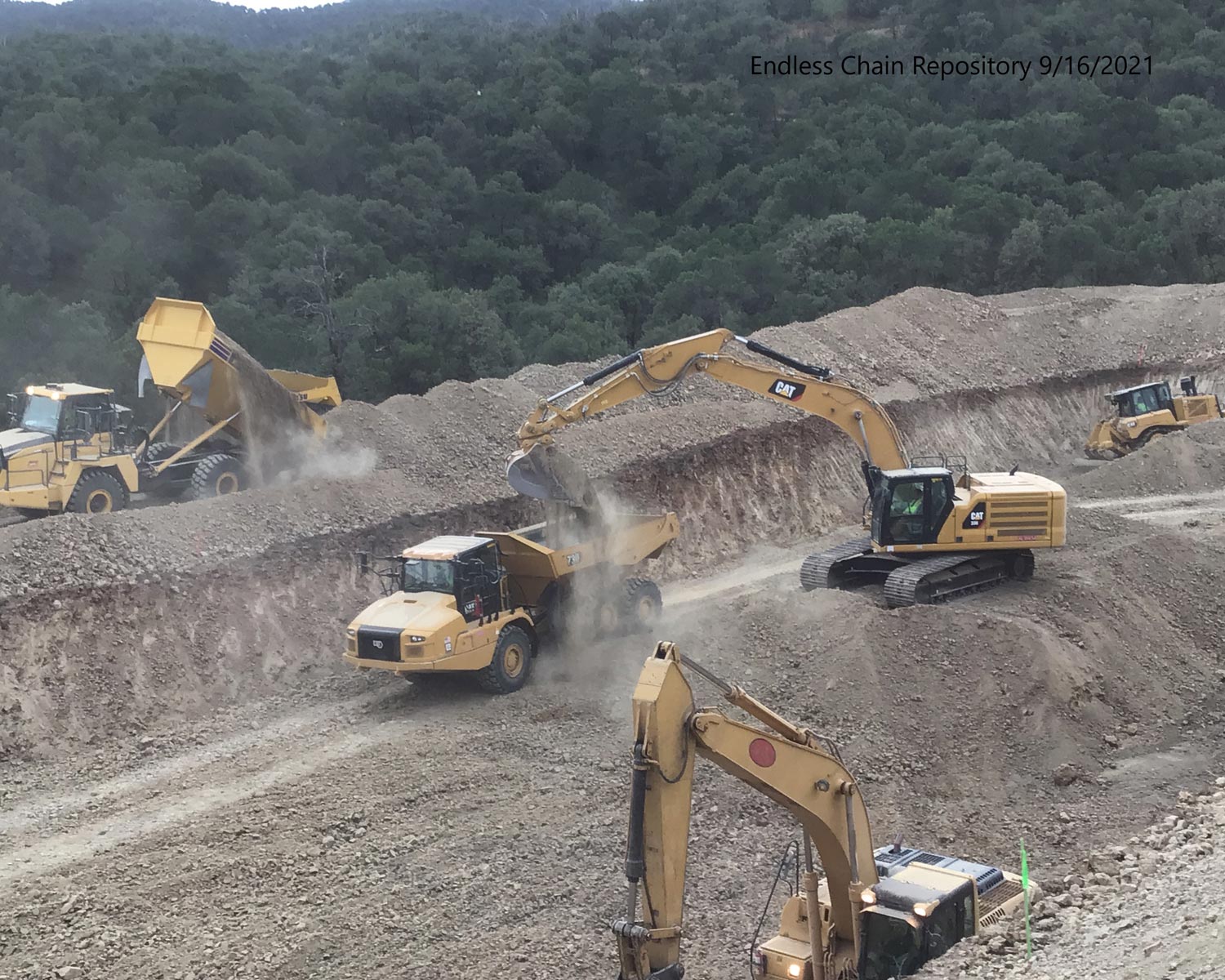
The Coronado National Forest is a United States National Forest that includes an area of about 1.78 million acres spread throughout mountain ranges in southeastern Arizona and southwestern New Mexico. Under CERCLA, officials developed an environmental cleanup plan for the abandoned Harshaw Creek Mines Sites within the forest.
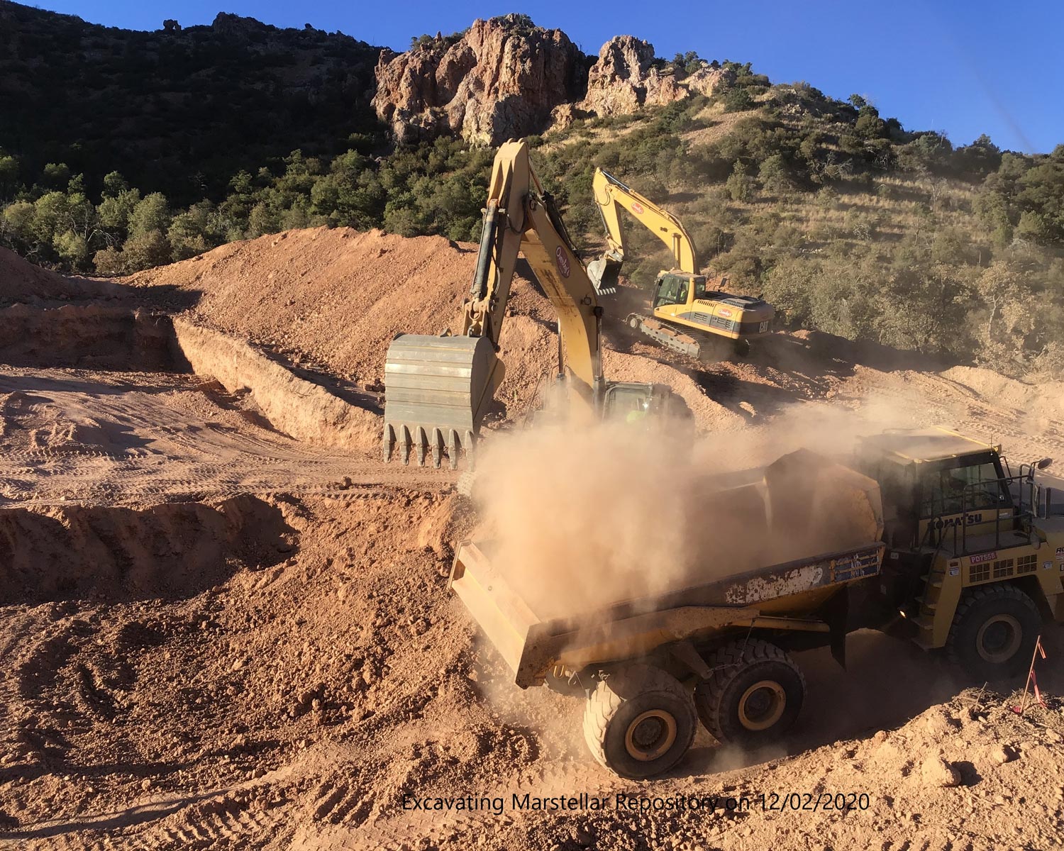
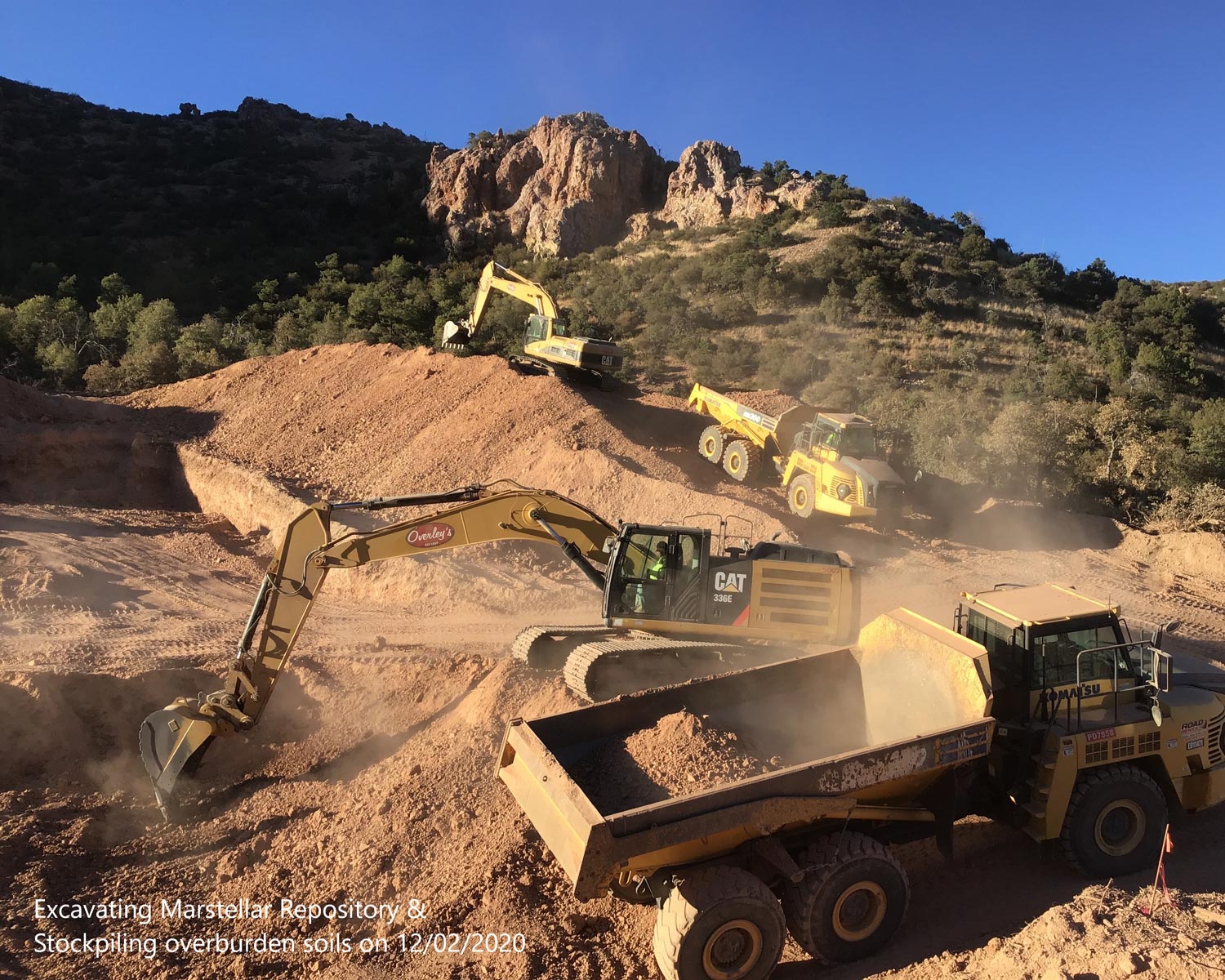
With a redesign required of the Marstellar Consolidation Cell to accommodate more waste, the Pioneer Team worked closely with the Forest Service to develop alternate plans and implement the preferred alternative. At the Endless Chain Waste Rock site, more waste was consolidated in place than planned and the site was redesigned to accommodate the change.
To remediate the Upper Harshaw Creek Mines in the Coronado National Forest, Santa Cruz County, Arizona, the Pioneer Team implemented a Forest Service design to reclaim historic mine waste at these sites.
Remediation work involved:
Oversight work required before and after surveys to calculate waste volumes and provide as-built drawings. Density testing was conducted within the consolidation cells to verify proper compaction.
Due to unforeseen conditions, the Pioneer team had to employ an adaptive approach to accommodate rock excavation in the consolidation cells and significant increases in waste volumes (over 56%). By working closely with the Forest Service we were able to overcome these challenges and complete all work within the required project timeline.
Work was completed at the Marstellar, Augusta, and Blue Nose sites in early March 2021. Construction on the Endless Chain and Morning Glory sites was completed in December 2021.